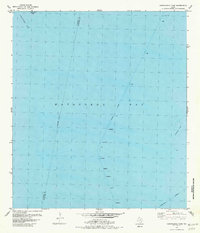
1980 Map of Carancahua Pass
USGS Topo · Published 1981About this map
Matagorda Bay dominates this coastal survey, where the Calhoun Co Matagorda Co line bisects the open water. The map documents the intricate maritime infrastructure of the early 1980s, tracing the deep-water Palacios Channel as it cuts across the bay floor toward the north. Navigational aids, labeled simply as Light and Daybeacon, mark the essential paths for Gulf vessels navigating the transition from the Intracoastal Waterway through Carancahua Pass. To the southeast, the submerged topography of Halfmoon Reef provides a notable landmark for those studying the shifting shoreline and oyster reef formations of the Texas coast. This edition reflects hydrographic data compiled just after the late 1970s, offering a precise view of the seafloor before modern coastal changes.
Find a feature on this map
9 named features on this map. Tap any name to fly to it.
Don’t see what you’re looking for? This feature index may not catch every label — zoom into the map to look around manually.
Map Details
Editions of this 1980 Carancahua Pass Map
This is the sole edition of this map. No revisions or reprints were ever made.
Other maps of this area

1951 · Keller Bay
USGS Topo · 1:24,000

1952 · Palacios Point
USGS Topo · 1:24,000

1952 · Palacios
USGS Topo · 1:24,000

1952 · Olivia
USGS Topo · 1:24,000

1952 · Turtle Bay
USGS Topo · 1:24,000

1952 · South of Palacios Point
USGS Topo · 1:24,000

1952 · Decros Point
USGS Topo · 1:24,000

1952 · Port O'Connor
USGS Topo · 1:24,000

1953 · Beeville
USGS Topo · 1:250,000

1956 · Beeville
USGS Topo · 1:250,000