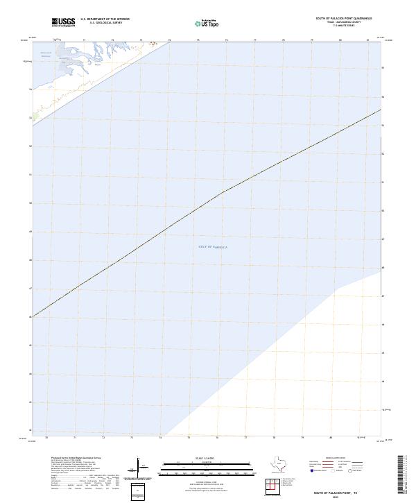
2025 Map of South of Palacios Point
USGS Topo · Published 2025About this map
Matagorda Bay and the winding channel of the Intracoastal Waterway dominate the northern margins of this 2025 survey, where the Texas coastline meets the open sea. This coastal landscape is defined by the shifting interface of water and land, characterized by the tidal inlets of Greens Bayou and the expansive reach of the Gulf of America to the south. The mapping reflects a specialized maritime environment where navigation and hydrography are central to the region's character, providing a precise record of the shoreline and maritime passages before the inevitable changes brought by coastal erosion and rising sea levels. The sparsity of terrestrial landmarks underscores the isolation of these barrier islands and marshlands, making it an essential reference for understanding the current state of Matagorda County's vulnerable gulf-front geography.
Find a feature on this map
4 named features on this map. Tap any name to fly to it.
Don’t see what you’re looking for? This feature index may not catch every label — zoom into the map to look around manually.
Map Details
Editions of this 2025 South of Palacios Point Map
This is the sole edition of this map. No revisions or reprints were ever made.
Other maps of this area

1952 · Palacios SE
USGS Topo · 1:24,000

1952 · Palacios Point
USGS Topo · 1:24,000

1952 · South of Palacios Point
USGS Topo · 1:24,000

1952 · Decros Point
USGS Topo · 1:24,000

1953 · Beeville
USGS Topo · 1:250,000

1956 · Beeville
USGS Topo · 1:250,000

1960 · Beeville
USGS Topo · 1:250,000
1980 · Carancahua Pass
USGS Topo · 1:24,000
1983 · San Antonio Bay
USGS Topo · 1:100,000
1984 · Port Lavaca
USGS Topo · 1:100,000