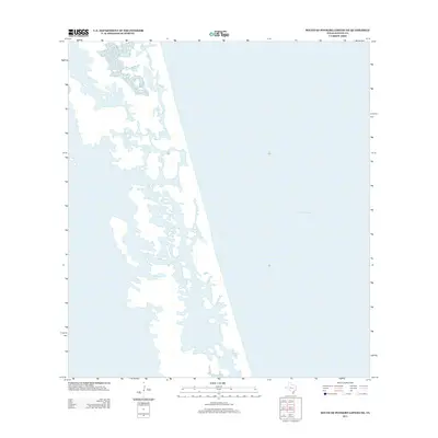
2013 Map of South of Potrero Lopeno NE
USGS Topo · Published 2013About this map
The vast, fluid interface of the Texas coastline takes center stage in this Kenedy County study. Dominated by the waters of the Gulf of Mexico, the map documents a shifting environment of barrier islands, tidal flats, and intricate lagoon systems. Unlike inland surveys defined by town grids and road networks, this area is characterized by its dynamic hydrography and the absence of permanent human settlement. The intricate web of sandbars and shallow inlets illustrates the natural coastal processes at work along this secluded stretch of the Gulf, where the land and sea frequently redefine one another through sediment transport and seasonal tidal surges.
Find a feature on this map
1 named feature on this map. Tap any name to fly to it.
Don’t see what you’re looking for? This feature index may not catch every label — zoom into the map to look around manually.
Map Details
Editions of this 2013 South of Potrero Lopeno NE Map
This is the sole edition of this map. No revisions or reprints were ever made.
Other maps of this area

1923 · Lopena Island
USGS Topo · 1:62,500

1951 · South of Potrero Lopeno NE
USGS Topo · 1:24,000

1952 · Potrero Lopeno SE
USGS Topo · 1:24,000

1952 · South of Potrero Lopeno NW
USGS Topo · 1:24,000

1952 · South of Potrero Lopeno SE
USGS Topo · 1:24,000

1952 · Port Mansfield
USGS Topo · 1:24,000

1952 · Potrero Lopeno SW
USGS Topo · 1:24,000

1952 · Potrero Lopeno
USGS Topo · 1:62,500

1952 · South of Potrero Lopeno
USGS Topo · 1:62,500

1953 · Brownsville
USGS Topo · 1:250,000