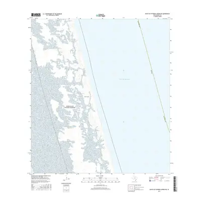
2016 Map of South of Potrero Lopeno NE
USGS Topo · Published 2016About this map
Padre Island National Seashore dominates this 2016 coastal survey, capturing the dynamic environment of this barrier island along the South Texas coast. The map illustrates the complex network of wetlands and tidal flats that characterize the western edge of Padre Island, where the land meets the shallow Laguna Madre. To the east, the vast expanse of the Gulf of Mexico stretches toward the horizon, divided by a clearly marked state boundary line for Texas. This map serves as a vital record of the shoreline and coastal topography in Kenedy County before further environmental shifts, providing a detailed look at the island's low-elevation terrain and specialized ecosystem.
Find a feature on this map
5 named features on this map. Tap any name to fly to it.
Don’t see what you’re looking for? This feature index may not catch every label — zoom into the map to look around manually.
Map Details
Editions of this 2016 South of Potrero Lopeno NE Map
This is the sole edition of this map. No revisions or reprints were ever made.
Other maps of this area

1923 · Lopena Island
USGS Topo · 1:62,500

1951 · South of Potrero Lopeno NE
USGS Topo · 1:24,000

1952 · Potrero Lopeno SE
USGS Topo · 1:24,000

1952 · South of Potrero Lopeno NW
USGS Topo · 1:24,000

1952 · South of Potrero Lopeno SE
USGS Topo · 1:24,000

1952 · Port Mansfield
USGS Topo · 1:24,000

1952 · Potrero Lopeno SW
USGS Topo · 1:24,000

1952 · Potrero Lopeno
USGS Topo · 1:62,500

1952 · South of Potrero Lopeno
USGS Topo · 1:62,500

1953 · Brownsville
USGS Topo · 1:250,000