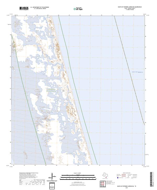
2025 Map of South of Potrero Lopeno NE
USGS Topo · Published 2025About this map
Padre Island National Seashore dominates this coastal landscape in Kenedy County, where the shift between the barrier island and the open waters of the Gulf of America is documented in high detail. The map illustrates the complex, shifting topography of Padre Island, characterized by extensive sand flats, tidal inlets, and a network of small, unnamed lagoons. The absence of permanent human structures or roads underscores the region's character as a protected ecological zone, preserved to allow natural barrier island processes to occur without interference. This study provides a precise view of the shoreline and maritime boundary as they existed in the mid-2020s, showing the intricate relationship between the wind-swept island and the sea.
Find a feature on this map
3 named features on this map. Tap any name to fly to it.
Don’t see what you’re looking for? This feature index may not catch every label — zoom into the map to look around manually.
Map Details
Editions of this 2025 South of Potrero Lopeno NE Map
This is the sole edition of this map. No revisions or reprints were ever made.
Other maps of this area

1923 · Lopena Island
USGS Topo · 1:62,500

1951 · South of Potrero Lopeno NE
USGS Topo · 1:24,000

1952 · Potrero Lopeno SE
USGS Topo · 1:24,000

1952 · South of Potrero Lopeno NW
USGS Topo · 1:24,000

1952 · South of Potrero Lopeno SE
USGS Topo · 1:24,000

1952 · Port Mansfield
USGS Topo · 1:24,000

1952 · Potrero Lopeno SW
USGS Topo · 1:24,000

1952 · Potrero Lopeno
USGS Topo · 1:62,500

1952 · South of Potrero Lopeno
USGS Topo · 1:62,500

1953 · Brownsville
USGS Topo · 1:250,000