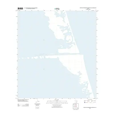
2012 Map of South of Potrero Lopeno SE
USGS Topo · Published 2012About this map
Port Mansfield Channel serves as the primary focal point of this coastal survey, cutting a straight course through the barrier island geography of Willacy County. The map provides a detailed look at the aquatic landscape where the Laguna Madre meets the Gulf of Mexico, illustrating the intricate shoreline and sand flats that characterize this section of the Texas coast. Unlike more developed coastal areas, this region is defined by its maritime infrastructure and the natural movement of the tide across the barrier bars. The presence of the channel highlights the mid-20th-century efforts to provide deep-water access for the local fishing and shipping industries, a development that fundamentally altered the local hydrology and navigation patterns.
Find a feature on this map
1 named feature on this map. Tap any name to fly to it.
Don’t see what you’re looking for? This feature index may not catch every label — zoom into the map to look around manually.
Map Details
Editions of this 2012 South of Potrero Lopeno SE Map
This is the sole edition of this map. No revisions or reprints were ever made.
Other maps of this area

1951 · South of Potrero Lopeno NE
USGS Topo · 1:24,000

1952 · Green Island
USGS Topo · 1:24,000

1952 · South of Potrero Lopeno NW
USGS Topo · 1:24,000
1952 · North Of Port Isabel NW
USGS Topo · 1:24,000

1952 · South of Potrero Lopeno SE
USGS Topo · 1:24,000

1952 · Hawk Island
USGS Topo · 1:24,000

1952 · Port Mansfield
USGS Topo · 1:24,000

1952 · South of Potrero Lopeno
USGS Topo · 1:62,500

1953 · Brownsville
USGS Topo · 1:250,000
1955 · La Leona
USGS Topo · 1:62,500