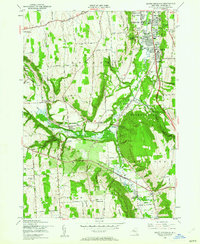
1955 Map of South Onondaga
USGS Topo · Published 1962About this map
The Onondaga Indian Reservation anchors the central landscape of this mid-century survey, where the West Branch Onondaga Creek joins the main waters of Onondaga Creek. This hydrology is further managed by the Onondaga Creek Flood Control Dam and its associated spillway. The map captures a mix of traditional rural crossroads like South Onondaga and Ironsides alongside mid-century infrastructure, including the WSYR radio towers and the Nedrow Air Park.
Find a feature on this map
62 named features on this map. Tap any name to fly to it.
Don’t see what you’re looking for? This feature index may not catch every label — zoom into the map to look around manually.
Map Details
Editions of this 1955 South Onondaga Map
3 editions found
Other maps of this area

1895 · Syracuse
USGS Topo · 1:62,500

1898 · Syracuse
USGS Topo · 1:62,500

1899 · Skaneateles
USGS Topo · 1:62,500

1900 · Baldwinsville
USGS Topo · 1:62,500

1900 · Tully
USGS Topo · 1:62,500

1902 · Skaneateles
USGS Topo · 1:62,500

1938 · Syracuse East
USGS Topo · 1:24,000

1939 · Syracuse West
USGS Topo · 1:24,000
1943 · Syracuse East
USGS Topo · 1:31,680

1943 · South Onondaga
USGS Topo · 1:31,680