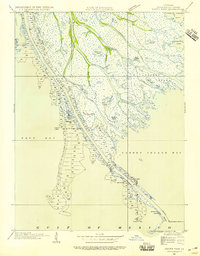
1935 Map of South Pass
USGS Topo · Published 1955About this map
The intricate alluvial fingers of the Mississippi River Delta reach into the Gulf of Mexico in this mid-1930s survey of the southernmost tip of Louisiana. The landscape is defined by a complex web of distributaries and marshlands, including Dennis Pass, Loomis Pass, and Cognevich Pass, which channel sediment and water through the bird-foot delta. At the very edge of the continent, Port Eads serves as a remote outpost for maritime activity, supported by the Pilot Sta and the South Pass E Jetty L H lighthouse marking the gateway to the river's interior. This era shows the delta's form before significant modern coastal erosion, where names like Valentiers Pond and Morgan Pond identify specific pockets of open water within the vast marshy expanse between East Bay and Garden Island Bay.
Find a feature on this map
36 named features on this map. Tap any name to fly to it.
Don’t see what you’re looking for? This feature index may not catch every label — zoom into the map to look around manually.
Map Details
Editions of this 1935 South Pass Map
3 editions found
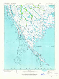
Other maps of this area

1893 · East Delta
USGS Topo · 1:62,500

1893 · West Delta
USGS Topo · 1:62,500

1935 · Garden Island Pass
USGS Topo · 1:31,680

1935 · South Pass
USGS Topo · 1:31,680

1946 · Mudpan Bayou
USGS Topo · 1:31,680

1947 · Garden Island Pass
USGS Topo · 1:31,680

1947 · Pass A Loutre West
USGS Topo · 1:31,680

1947 · Southwest Pass
USGS Topo · 1:31,680

1947 · Pass A Loutre East
USGS Topo · 1:31,680

1949 · Cubits Gap
USGS Topo · 1:31,680