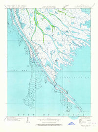
1935 Map of South Pass
USGS Topo · Published 1964About this map
Port Eads serves as a critical outpost at the edge of the Gulf of Mexico, marking the narrow passage where the Mississippi River delta meets the sea. This 1935 field examination reveals the intricate network of distributaries and marshes that define Plaquemines Parish, featuring a labyrinth of water bodies such as Valentiers Pond, Loomis Pond, and Johnson Pond. The maritime character of the region is emphasized by the Pilot Sta and the South Pass L H, alongside the engineered East Jetty and West Jetty that direct the flow of the South Pass.
Find a feature on this map
36 named features on this map. Tap any name to fly to it.
Don’t see what you’re looking for? This feature index may not catch every label — zoom into the map to look around manually.
Map Details
Editions of this 1935 South Pass Map
3 editions found
Other maps of this area

1893 · East Delta
USGS Topo · 1:62,500

1893 · West Delta
USGS Topo · 1:62,500

1935 · Garden Island Pass
USGS Topo · 1:31,680

1935 · South Pass
USGS Topo · 1:31,680

1946 · Mudpan Bayou
USGS Topo · 1:31,680

1947 · Garden Island Pass
USGS Topo · 1:31,680

1947 · Pass A Loutre West
USGS Topo · 1:31,680

1947 · Southwest Pass
USGS Topo · 1:31,680

1947 · Pass A Loutre East
USGS Topo · 1:31,680

1949 · Cubits Gap
USGS Topo · 1:31,680