1961 Map of South Peak
USGS Topo · Published 1986About this map
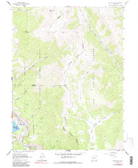
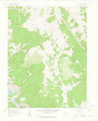
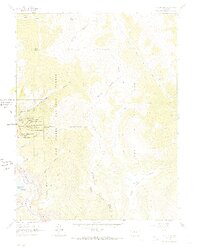
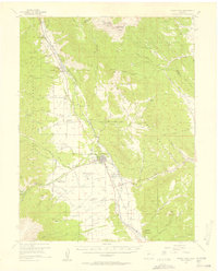
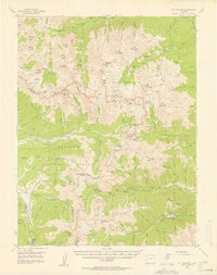
South Peak and Black Mountain dominate this high-altitude landscape along the Continental Divide where the borders of Lake, Park, and Chaffee counties meet. The western edge of the map follows the corridor of the Arkansas River, featuring the Clear Creek Reservoir and a technical infrastructure that includes a Gaging Sta and a Gravel Pit. Transportation history is clearly etched into the terrain via the Denver and Rio Grande Western line and an Old Railroad Grade that winds through the drainage of Columbia Creek. To the east, the headwaters of the South Fork South Platte River and the descriptively named Rough and Tumbling Creek flow through the Pike National Forest. This era of the map shows a wilderness managed through a network of pack trails, including a prominent Pack Trail crossing the San Isabel National Forest near Low Pass Gulch.
Find a feature on this map
32 named features on this map. Tap any name to fly to it.
Don’t see what you’re looking for? This feature index may not catch every label — zoom into the map to look around manually.
Map Details
Editions of this 1961 South Peak Map
3 editions found
Other maps of this area

1889 · Leadville
USGS Topo · 1:125,000

1891 · Leadville
USGS Topo · 1:125,000
1935 · Mount Elbert
USGS Topo · 1:62,500

1938 · Mount Elbert
USGS Topo · 1:62,500

1939 · Mount Elbert
USGS Topo · 1:62,500

1942 · Leadville
USGS Topo · 1:125,000
1955 · Buena Vista
USGS Topo · 1:62,500
1955 · Mount Harvard
USGS Topo · 1:62,500

1956 · Montrose
USGS Topo · 1:250,000

1957 · Leadville
USGS Topo · 1:250,000