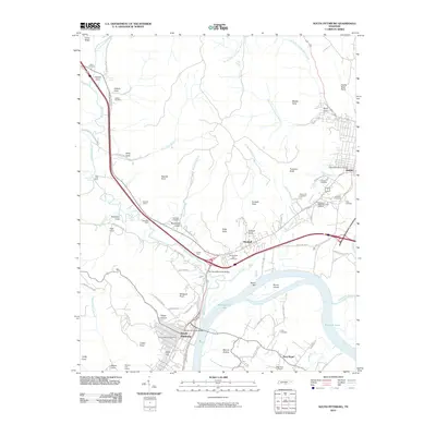
2010 Map of South Pittsburg
USGS Topo · Published 2010About this map
South Pittsburg and the surrounding Tennessee River valley are defined by a complex geography of mountain coves and industrial development. This survey highlights the region's diverse settlement patterns, from the organized streets near the South Pittsburg Post Office to the isolated communities of Gizzard Cove, Kelly Cove, and Sweetens Cove. The river remains a central feature, with Guntersville Lake and the Sequatchie River dominating the southern half of the sheet. Modern infrastructure is represented by the Pat Layne Memorial Bridge and the Shelby Rhinehart Bridge, which connect these river communities.
Find a feature on this map
98 named features on this map. Tap any name to fly to it.
Don’t see what you’re looking for? This feature index may not catch every label — zoom into the map to look around manually.
Map Details
Editions of this 2010 South Pittsburg Map
This is the sole edition of this map. No revisions or reprints were ever made.
Other maps of this area

1886 · Stevenson
USGS Topo · 1:125,000

1892 · Stevenson
USGS Topo · 1:125,000

1895 · Stevenson
USGS Topo · 1:125,000

1895 · Sewanee
USGS Topo · 1:125,000

1936 · Shellmound
USGS Topo · 1:24,000

1936 · Orme
USGS Topo · 1:24,000

1936 · Bridgeport
USGS Topo · 1:24,000

1936 · Whitwell
USGS Topo · 1:24,000

1936 · Monteagle
USGS Topo · 1:24,000

1936 · White City
USGS Topo · 1:24,000