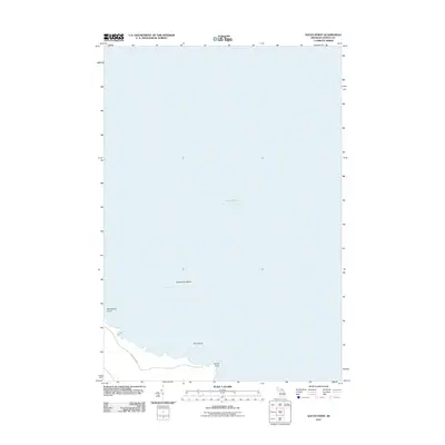
2011 Map of South Point
USGS Topo · Published 2011About this map
Lake Huron dominates this coastal landscape along the eastern edge of Alpena County, where the shoreline of Thunder Bay meets the open water. The map documents a sparsely developed reach of Sanborn Township, defined by its maritime features rather than dense settlement. Notable landforms include South Point and Hardwood Point, which frame the small inlets of the coast. Offshore, the survey identifies isolated landmasses such as Scarecrow Island and Bird Island, providing essential detail for researchers interested in the historical geography of the Michigan shoreline. Landward access is primarily represented by Brousseau Rd, illustrating the limited road network that serviced this waterfront area during the early 21st century. The map provides a precise look at the interface between the lake and the low-lying coastal terrain prior to more modern shoreline changes.
Find a feature on this map
7 named features on this map. Tap any name to fly to it.
Don’t see what you’re looking for? This feature index may not catch every label — zoom into the map to look around manually.
Map Details
Editions of this 2011 South Point Map
This is the sole edition of this map. No revisions or reprints were ever made.
Other maps of this area

1954 · Tawas City
USGS Topo · 1:250,000

1954 · Alpena
USGS Topo · 1:250,000

1957 · Alpena
USGS Topo · 1:250,000

1958 · Alpena
USGS Topo · 1:250,000

1958 · Tawas City
USGS Topo · 1:250,000

1969 · Alpena
USGS Topo · 1:250,000

1971 · Alpena
USGS Topo · 1:24,000
1971 · Thunder Bay Island
USGS Topo · 1:24,000

1971 · Spruce
USGS Topo · 1:24,000

1971 · North Point
USGS Topo · 1:24,000