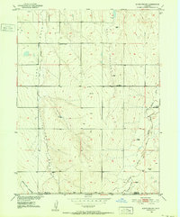
1950 Map of South Roggen
USGS Topo · Published 1952About this map
South Roggen and the surrounding high plains are documented here just as the Department of the Interior was focusing on the Missouri River Basin development. The landscape is characterized by its drainage patterns, notably Long Draw Creek and Hay Gulch, which feed into the larger prairie system. Small, localized points of interest like Dido and De Spain suggest early attempts at settlement or landholding in this arid stretch of Weld County. Evidence of shifting infrastructure is clear in the Henrylyn Canal (Abandoned), which traces the southwestern corner of the sheet, reflecting the early 20th-century challenges of western irrigation. Scattered windmills and wells serve as critical landmarks for ranchers, while the early Television Relay Station in the central hills represents the introduction of modern communications technology to the rural Colorado interior at mid-century.
Find a feature on this map
13 named features on this map. Tap any name to fly to it.
Don’t see what you’re looking for? This feature index may not catch every label — zoom into the map to look around manually.
Map Details
Editions of this 1950 South Roggen Map
3 editions found
Other maps of this area

1949 · Sunnydale
USGS Topo · 1:24,000

1950 · South Roggen
USGS Topo · 1:24,000

1950 · Wiggins SW
USGS Topo · 1:24,000

1950 · Tampa
USGS Topo · 1:24,000

1950 · Prospect Valley
USGS Topo · 1:24,000

1951 · Prospect Valley
USGS Topo · 1:24,000

1951 · Living Springs
USGS Topo · 1:24,000

1951 · Roggen
USGS Topo · 1:24,000

1951 · Leader NW
USGS Topo · 1:24,000

1951 · Omar
USGS Topo · 1:24,000