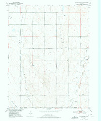
1950 Map of South Roggen
USGS Topo · Published 1975About this map
South Roggen sits at the northern edge of a landscape defined by seasonal drainage and agricultural infrastructure in Weld County. This mid-century survey reveals the transition between the plains and the rolling breaks of the Colorado prairie, featuring prominent landmarks like Dido and De Spain. The presence of the Henrylyn Canal (Abandoned) at the southern boundary highlights a shift in water management and land use during the development of the Missouri River Basin.
Find a feature on this map
12 named features on this map. Tap any name to fly to it.
Don’t see what you’re looking for? This feature index may not catch every label — zoom into the map to look around manually.
Map Details
Editions of this 1950 South Roggen Map
3 editions found
Other maps of this area

1949 · Sunnydale
USGS Topo · 1:24,000

1950 · South Roggen
USGS Topo · 1:24,000

1950 · Wiggins SW
USGS Topo · 1:24,000

1950 · Tampa
USGS Topo · 1:24,000

1950 · Prospect Valley
USGS Topo · 1:24,000

1951 · Prospect Valley
USGS Topo · 1:24,000

1951 · Living Springs
USGS Topo · 1:24,000

1951 · Roggen
USGS Topo · 1:24,000

1951 · Leader NW
USGS Topo · 1:24,000

1951 · Omar
USGS Topo · 1:24,000