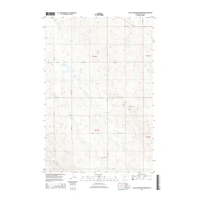
2014 Map of South Sandstone Reservoir
USGS Topo · Published 2014About this map
S Sandstone Reservoir acts as the primary hydrological center for this portion of Fallon County, collecting drainage from the surrounding plains. The local landscape is defined by the winding paths of S Fork Sandstone Cr and its tributaries, including Coon Cr and Timber Cr. A network of rural access roads and trails, such as Sunny Bank Rd and Reservoir Trl, reflects the agricultural and recreational layout of the region in the early 21st century. The map depicts a transition from highway-accessible areas near Us-12 and Green Acres Rd in the north to more remote ranching terrain in the south. The presence of Ducharme Acc and Coon Creek Loop suggests established local access points to the creek systems and waterfront, illustrating how modern land management and irrigation needs have shaped the eastern Montana prairie.
Find a feature on this map
18 named features on this map. Tap any name to fly to it.
Don’t see what you’re looking for? This feature index may not catch every label — zoom into the map to look around manually.
Map Details
Editions of this 2014 South Sandstone Reservoir Map
This is the sole edition of this map. No revisions or reprints were ever made.
Other maps of this area

1953 · Miles City
USGS Topo · 1:250,000

1957 · Miles City
USGS Topo · 1:250,000

1958 · Miles City
USGS Topo · 1:250,000

1981 · Baker
USGS Topo · 1:100,000

1981 · Baker NE
USGS Topo · 1:24,000

1981 · Baker
USGS Topo · 1:24,000

1981 · South Sandstone Reservoir
USGS Topo · 1:24,000

1981 · Willard
USGS Topo · 1:24,000

1981 · Little Pine Creek
USGS Topo · 1:24,000

1981 · Baker NW
USGS Topo · 1:24,000