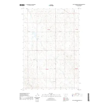
2020 Map of South Sandstone Reservoir
USGS Topo · Published 2020About this map
The S Fork Sandstone Cr and Timber Cr define the drainage patterns of this Fallon County landscape, where the high plains are segmented by a network of local roads and trails. This 2020 topographical survey reveals a rural area organized by the Public Land Survey System, featuring township boundaries like t7n r58e and t6n r58e. The road network provides insight into modern land use and access, with names like Green Acres Rd, John Deere Ln, and Sunny Bank Rd suggesting agricultural and residential divisions. Along the western edge, the Reservoir Trl follows the contours of the land near the waterways. The presence of Coon Creek Loop and Tower Rd further illustrates the localized infrastructure developed around the tributary valleys of Coon Cr and Pine Cr.
Find a feature on this map
18 named features on this map. Tap any name to fly to it.
Don’t see what you’re looking for? This feature index may not catch every label — zoom into the map to look around manually.
Map Details
Editions of this 2020 South Sandstone Reservoir Map
This is the sole edition of this map. No revisions or reprints were ever made.
Other maps of this area

1953 · Miles City
USGS Topo · 1:250,000

1957 · Miles City
USGS Topo · 1:250,000

1958 · Miles City
USGS Topo · 1:250,000

1981 · Baker
USGS Topo · 1:100,000

1981 · Baker NE
USGS Topo · 1:24,000

1981 · Baker
USGS Topo · 1:24,000

1981 · South Sandstone Reservoir
USGS Topo · 1:24,000

1981 · Willard
USGS Topo · 1:24,000

1981 · Little Pine Creek
USGS Topo · 1:24,000

1981 · Baker NW
USGS Topo · 1:24,000