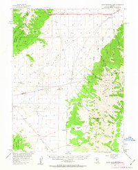
1956 Map of South Shoshone Peak
USGS Topo · Published 1963About this map
South Shoshone Peak towers over this mid-century landscape, anchoring the eastern mountains within the Toiyabe National Forest. The map documents a sparsely populated corridor of central Nevada, where the high desert of Ione Valley meets the rising Toiyabe Range and the Desatoya Mountains to the northwest. Human activity is marked by seasonal or isolated outposts like Peterson Station and Campbell, alongside small named locations such as Sunnyside and Idlewild.
Find a feature on this map
45 named features on this map. Tap any name to fly to it.
Don’t see what you’re looking for? This feature index may not catch every label — zoom into the map to look around manually.
Map Details
Editions of this 1956 South Shoshone Peak Map
3 editions found
Other maps of this area

1907 · Tonopah
USGS Topo · 1:250,000

1908 · Tonopah
USGS Topo · 1:250,000

1948 · Paradise Peak
USGS Topo · 1:62,500

1948 · Ione
USGS Topo · 1:62,500

1950 · Paradise Peak
USGS Topo · 1:62,500

1950 · Ione
USGS Topo · 1:62,500

1955 · Millett
USGS Topo · 1:250,000

1956 · South Shoshone Peak
USGS Topo · 1:62,500

1956 · North Shoshone Peak
USGS Topo · 1:62,500

1956 · Tonopah
USGS Topo · 1:250,000