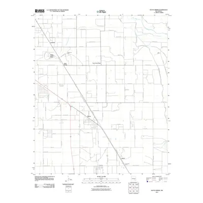
2010 Map of South Spring
USGS Topo · Published 2010About this map
The Pecos River and its tributary, the South Spring River, carve through this section of the Chaves County plains, defining a landscape shaped by intensive water management. The irrigation network is dominated by the prominent Hagerman Canal, which runs north-to-south to support the agricultural settlements of East Grand Plains and Midway. This 2010 survey illustrates a region where ranching history and modern infrastructure meet, evidenced by the large South Spring Ranch and Oasis Ranch. To the south, the community of Chisum and the Orchard Park Station near the southern boundary reflect the importance of rail and road transport in moving goods from these desert plains. The grid of county highways and named roads like Milky Way Rd and Cedarvale Rd connect the scattered residential clusters of South Spring Acres and Fairbanks.
Find a feature on this map
84 named features on this map. Tap any name to fly to it.
Don’t see what you’re looking for? This feature index may not catch every label — zoom into the map to look around manually.
Map Details
Editions of this 2010 South Spring Map
This is the sole edition of this map. No revisions or reprints were ever made.
Other maps of this area

1949 · Peters Lake
USGS Topo · 1:24,000

1949 · Roswell North
USGS Topo · 1:24,000

1949 · Roswell South
USGS Topo · 1:24,000

1950 · Dexter West
USGS Topo · 1:24,000

1950 · Comanche Spring
USGS Topo · 1:24,000

1950 · Bottomless Lakes
USGS Topo · 1:24,000

1950 · South Spring
USGS Topo · 1:24,000

1950 · Bitter Lake
USGS Topo · 1:24,000

1950 · Dexter East
USGS Topo · 1:24,000

1955 · Roswell
USGS Topo · 1:250,000