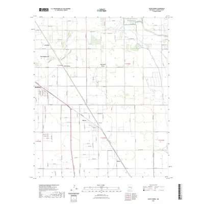
2023 Map of South Spring
USGS Topo · Published 2023About this map
The Pecos River valley southeast of Roswell is defined by its complex irrigation and drainage network, including the prominent Hagerman Canal and South Spring River. This landscape reflects a longstanding reliance on water management in the Chaves County desert, where a series of small residential developments and unincorporated communities have taken root along the arterial SE Main St. Settlements such as South Spring, South Spring Acres, and Fairbanks appear as distinct clusters among the agricultural grid. To the northeast, the Bitter Lake National Wildlife Refuge marks a significant transition toward the river's edge, preserving critical wetland habitats. The map also traces the smaller nodes of Midway and Chisum, showing how residential expansion and rural industry follow the path of established roads like Co Rd 175 and E Grand Plains Rd.
Find a feature on this map
114 named features on this map. Tap any name to fly to it.
Don’t see what you’re looking for? This feature index may not catch every label — zoom into the map to look around manually.
Map Details
Editions of this 2023 South Spring Map
This is the sole edition of this map. No revisions or reprints were ever made.
Other maps of this area

1949 · Peters Lake
USGS Topo · 1:24,000

1949 · Roswell North
USGS Topo · 1:24,000

1949 · Roswell South
USGS Topo · 1:24,000

1950 · Dexter West
USGS Topo · 1:24,000

1950 · Comanche Spring
USGS Topo · 1:24,000

1950 · Bottomless Lakes
USGS Topo · 1:24,000

1950 · South Spring
USGS Topo · 1:24,000

1950 · Bitter Lake
USGS Topo · 1:24,000

1950 · Dexter East
USGS Topo · 1:24,000

1955 · Roswell
USGS Topo · 1:250,000