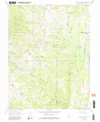
1966 Map of South Tent Mountain
USGS Topo · Published 1980About this map
Manti-La Sal National Forest dominates this high-altitude landscape along the Sanpete and Emery county line, where an intricate network of early water management infrastructure supported the valley below. Local ranchers and sheepherders utilized high-country grazing lands like Soren Peterson Meadow and Sheep Canyon Flat, while the complex hydraulics of the Potters Canyon Ditch and City Ditch redirected snowmelt through the mountains. Engineering for water transport is evident in the Mountain Tunnel and Cedar Creek Tunnel, which pierced the ridges to deliver water across the divide. Travelers on Skyline Drive passed landmarks such as North Tent Mtn and South Tent Mtn, following routes that connected isolated outposts like Becks Cabin to the larger canyon systems. The map captures a moment when traditional land use and systematic watershed development defined the character of the Wasatch Plateau.
Find a feature on this map
55 named features on this map. Tap any name to fly to it.
Don’t see what you’re looking for? This feature index may not catch every label — zoom into the map to look around manually.
Map Details
Editions of this 1966 South Tent Mountain Map
Other maps of this area

1885 · Manti
USGS Topo · 1:250,000

1895 · Manti
USGS Topo · 1:250,000

1923 · Scofield
USGS Topo · 1:62,500

1923 · Hiawatha
USGS Topo · 1:62,500

1925 · Scofield
USGS Topo · 1:62,500

1925 · Hiawatha
USGS Topo · 1:62,500

1956 · Price
USGS Topo · 1:250,000

1960 · Price
USGS Topo · 1:250,000

1962 · Price
USGS Topo · 1:250,000

1965 · Huntington Reservoir
USGS Topo · 1:24,000