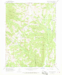
1966 Map of South Tent Mtn
USGS Topo · Published 1968About this map
Soren Peterson Meadow and Becks Cabin represent the small-scale human footprint within this high-elevation portion of the Manti-La Sal National Forest. Mapping in the mid-1960s shows a landscape defined by the drainage systems of Black Canyon and Lowry Water, where infrastructure was largely limited to the Skyline Drive and various specialized conduits like the Mountain Tunnel and Cedar Creek Tunnel. The terrain is marked by prominent peaks including North Tent Mtn and South Tent Mtn, which overlook a network of ridges such as Bacon Rind Ridge and Bulger Ridge. This survey documents the area's transition between Sanpete and Emery counties, highlighting how mountain geography dictated the movement of water and people through locations like Potters Ponds and along several established pack trails.
Find a feature on this map
47 named features on this map. Tap any name to fly to it.
Don’t see what you’re looking for? This feature index may not catch every label — zoom into the map to look around manually.
Map Details
Editions of this 1966 South Tent Mtn Map
Other maps of this area

1885 · Manti
USGS Topo · 1:250,000

1895 · Manti
USGS Topo · 1:250,000

1923 · Scofield
USGS Topo · 1:62,500

1923 · Hiawatha
USGS Topo · 1:62,500

1925 · Scofield
USGS Topo · 1:62,500

1925 · Hiawatha
USGS Topo · 1:62,500

1956 · Price
USGS Topo · 1:250,000

1960 · Price
USGS Topo · 1:250,000

1962 · Price
USGS Topo · 1:250,000

1965 · Huntington Reservoir
USGS Topo · 1:24,000