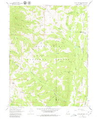
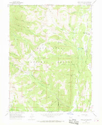
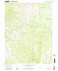
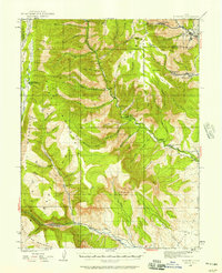
1966 Map of South Tent Mtn
USGS Topo · Published 1980About this map
The Manti-La Sal National Forest high country, situated along the Sanpete and Emery County border, is defined by an intricate network of water management features and high mountain peaks. High-elevation engineering is evident in the presence of the Mountain Tunnel, the Cedar Creek Tunnel, and a Gaging Station on Oak Creek. These developments, alongside the Black Canyon Ditch and Potters Canyon Ditch, illustrate the importance of water diversion and livestock management in this alpine environment during the mid-1960s.
Find a feature on this map
62 named features on this map. Tap any name to fly to it.
Don’t see what you’re looking for? This feature index may not catch every label — zoom into the map to look around manually.
Map Details
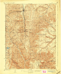
Editions of this 1966 South Tent Mtn Map
Other maps of this area

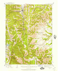
1885 · Manti
USGS Topo · 1:250,000

1895 · Manti
USGS Topo · 1:250,000
1923 · Scofield
USGS Topo · 1:62,500
1923 · Hiawatha
USGS Topo · 1:62,500
1925 · Scofield
USGS Topo · 1:62,500

1925 · Hiawatha
USGS Topo · 1:62,500

1956 · Price
USGS Topo · 1:250,000

1960 · Price
USGS Topo · 1:250,000

1962 · Price
USGS Topo · 1:250,000
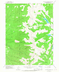
1965 · Huntington Reservoir
USGS Topo · 1:24,000