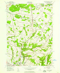
1955 Map of South Trenton
USGS Topo · Published 1957About this map
Ninemile Creek and the Feeder Canal define the lower-lying terrain of this mid-century New York landscape, which bridges the gap between the urban edge of Utica and the rural hill country to the north. Elevated landmarks such as Marcy Hill, Bell Hill, and Smith Hill dominate the topography, providing a stark contrast to the emerging residential development at Deerfield Heights. This era shows the community's social infrastructure through landmarks like Broadacres Sanatorium and local centers of worship and education, including Salem Ch and several district schools such as School No 10.
Find a feature on this map
61 named features on this map. Tap any name to fly to it.
Don’t see what you’re looking for? This feature index may not catch every label — zoom into the map to look around manually.
Map Details
Editions of this 1955 South Trenton Map
2 editions found
Other maps of this area

1895 · Oriskany
USGS Topo · 1:62,500

1897 · Remsen
USGS Topo · 1:62,500

1898 · Utica
USGS Topo · 1:62,500

1898 · Oriskany
USGS Topo · 1:62,500

1900 · Utica
USGS Topo · 1:62,500

1900 · Remsen
USGS Topo · 1:62,500

1904 · Boonville
USGS Topo · 1:62,500

1943 · Newport
USGS Topo · 1:24,000

1943 · Utica East
USGS Topo · 1:24,000
1943 · Ilion
USGS Topo · 1:24,000