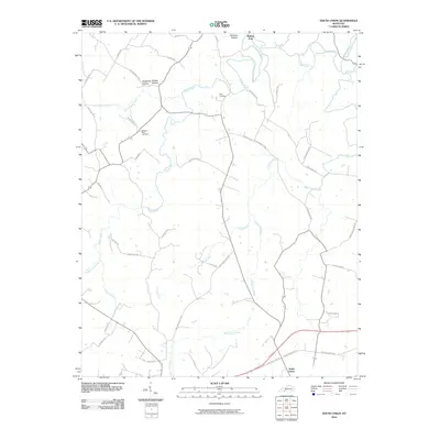
2010 Map of South Union
USGS Topo · Published 2010About this map
South Union serves as the primary focal point in this 2010 survey of Logan and Warren Counties, an area where the rolling Kentucky landscape is defined by the winding course of the Gasper River. The map reveals a dense network of local routes such as Shaker Bend Rd and Auburn-Richelieu Rd, which connect the scattered homesteads and agricultural plots of the region. For those tracing family histories, several burial sites are documented, including Felts Cemetery and the Gasper River Cemetery. The topography is marked by distinctive drainages and landforms like Shaker Hollow, Richelieu Hollow, and Epperson Hollow, illustrating how the early road system followed the contours of the terrain. The presence of Black Lick Creek and Crooked Run further highlights the hydraulic character of this rural district, while the Shaker Museum Rd points to the cultural heritage preserved near the South Union settlement.
Find a feature on this map
39 named features on this map. Tap any name to fly to it.
Don’t see what you’re looking for? This feature index may not catch every label — zoom into the map to look around manually.
Map Details
Editions of this 2010 South Union Map
This is the sole edition of this map. No revisions or reprints were ever made.
Other maps of this area

1911 · Dunmor
USGS Topo · 1:48,000

1914 · Little Muddy
USGS Topo · 1:62,500

1914 · Dunmor
USGS Topo · 1:62,500

1951 · Woodburn
USGS Topo · 1:24,000

1951 · Auburn
USGS Topo · 1:24,000

1951 · South Union
USGS Topo · 1:24,000

1951 · Homer
USGS Topo · 1:24,000

1952 · Dennis
USGS Topo · 1:24,000

1952 · Rockfield
USGS Topo · 1:24,000

1953 · Quality
USGS Topo · 1:24,000