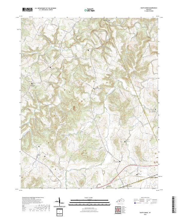
2022 Map of South Union
USGS Topo · Published 2022About this map
Gasper and the surrounding Logan County countryside are defined by the winding course of the Gasper River and its numerous tributaries, including Rock House Cr and Black Lick Cr. This agricultural landscape is dotted with family cemeteries and small rural congregations that speak to generations of local settlement. Along the southern edge, the community of South Union and the city of Auburn sit near the Logan and Simpson County line, connected by the busy corridor of Bowling Green Rd. The area's complex topography is evident in the many named lowlands such as Epperson Hollow, Shaker Hollow, and Richelieu Hollow. Genealogists will find a wealth of specific burial sites throughout the quadrangle, from the Woodward Graveyard and Chick Cem in the southwest to the Logan School House Cem further east, alongside historic parish centers like the Old Gasper River Church.
Find a feature on this map
80 named features on this map. Tap any name to fly to it.
Don’t see what you’re looking for? This feature index may not catch every label — zoom into the map to look around manually.
Map Details
Editions of this 2022 South Union Map
This is the sole edition of this map. No revisions or reprints were ever made.
Other maps of this area

1911 · Dunmor
USGS Topo · 1:48,000

1914 · Little Muddy
USGS Topo · 1:62,500

1914 · Dunmor
USGS Topo · 1:62,500

1951 · Woodburn
USGS Topo · 1:24,000

1951 · Auburn
USGS Topo · 1:24,000

1951 · South Union
USGS Topo · 1:24,000

1951 · Homer
USGS Topo · 1:24,000

1952 · Dennis
USGS Topo · 1:24,000

1952 · Rockfield
USGS Topo · 1:24,000

1953 · Quality
USGS Topo · 1:24,000