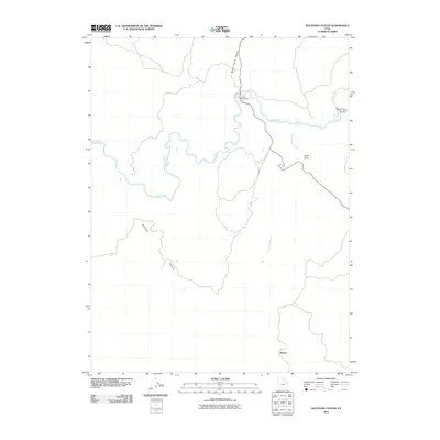
2011 Map of Southam Canyon
USGS Topo · Published 2011About this map
Ignatio Stage Stop and the settlement of Watson anchor this 2011 survey of the Uintah County high desert. The landscape is defined by the deep incisions of Southam Canyon and Wagon Hound Canyon, which drain toward the winding course of the White River. This area represents a critical intersection of early travel routes and rugged topography, where Evacuation Creek flows through the southeastern portion of the quadrangle. The naming of features like Duck Rock and Hells Hole Canyon reflects a tradition of descriptive, local landmarks used by travelers and ranchers navigating the drainages. While modern roads are present, the spatial arrangement of the stage stop and named canyons suggests the enduring influence of the historic geography in this portion of eastern Utah.
Find a feature on this map
8 named features on this map. Tap any name to fly to it.
Don’t see what you’re looking for? This feature index may not catch every label — zoom into the map to look around manually.
Map Details
Editions of this 2011 Southam Canyon Map
This is the sole edition of this map. No revisions or reprints were ever made.
Other maps of this area

1885 · East Tavaputs
USGS Topo · 1:250,000

1885 · Ashley
USGS Topo · 1:250,000

1907 · Jensen
USGS Topo · 1:125,000

1910 · Jensen
USGS Topo · 1:125,000

1954 · Vernal
USGS Topo · 1:250,000

1956 · Grand Junction
USGS Topo · 1:250,000

1958 · Vernal
USGS Topo · 1:250,000

1959 · Grand Junction
USGS Topo · 1:250,000

1960 · Vernal
USGS Topo · 1:250,000

1960 · Grand Junction
USGS Topo · 1:250,000