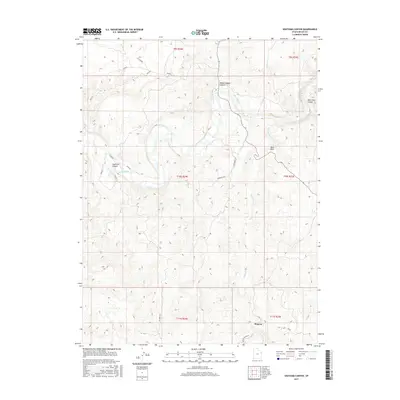
2017 Map of Southam Canyon
USGS Topo · Published 2017About this map
The White River meanders through the high desert of Uintah County, carving a deep path through a landscape defined by dramatic topographical relief and isolated outposts. The settlement of Watson sits in the southern portion of the sheet, serving as a focal point near the confluence of local routes like Watson Rainbow. The terrain is heavily dissected by numerous drainages and named landmarks, including the prominent Southam Canyon and the sharp profile of Duck Rock. This 2017 survey illustrates a modern view of a region historically shaped by geological exploration and remote ranching. The presence of Evacuation Cr and several deep canyons, such as Wagon Hound Canyon and Hells Hole Canyon, highlights the complex erosion patterns typical of the Uinta Basin. Connectivity in this sparsely populated area is maintained by the Bonanza Hwy and rural tracks like Pot Belly Rd, which traverse the high plateaus between the river valley and the surrounding ridges.
Find a feature on this map
16 named features on this map. Tap any name to fly to it.
Don’t see what you’re looking for? This feature index may not catch every label — zoom into the map to look around manually.
Map Details
Editions of this 2017 Southam Canyon Map
This is the sole edition of this map. No revisions or reprints were ever made.
Other maps of this area

1885 · East Tavaputs
USGS Topo · 1:250,000

1885 · Ashley
USGS Topo · 1:250,000

1907 · Jensen
USGS Topo · 1:125,000

1910 · Jensen
USGS Topo · 1:125,000

1954 · Vernal
USGS Topo · 1:250,000

1956 · Grand Junction
USGS Topo · 1:250,000

1958 · Vernal
USGS Topo · 1:250,000

1959 · Grand Junction
USGS Topo · 1:250,000

1960 · Vernal
USGS Topo · 1:250,000

1960 · Grand Junction
USGS Topo · 1:250,000