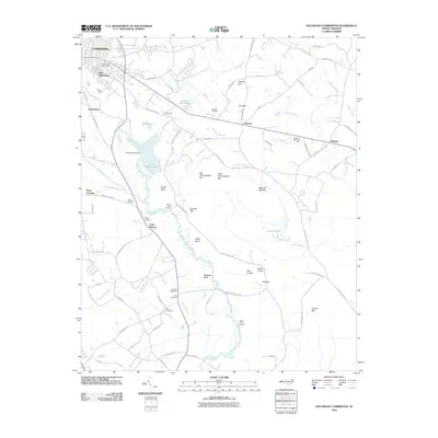
2010 Map of Southeast Lumberton
USGS Topo · Published 2010About this map
The Lumber River snakes through this Robeson County landscape, anchoring a network of low-lying wetlands and named geographic basins characteristic of the region. Local industry and utility are centered around the Plant Cooling Lake, created by the Cooling Lake Dam, while the outskirts of Lumberton transition into smaller communities such as East Lumberton, Hestertown, and Allenton. The map preserves numerous family and local landmarks, including the Hollywood Cemetery, Wishart Cemetery, and Britt Cemetery, which offer valuable data points for genealogical research in the area.
Find a feature on this map
88 named features on this map. Tap any name to fly to it.
Don’t see what you’re looking for? This feature index may not catch every label — zoom into the map to look around manually.
Map Details
Editions of this 2010 Southeast Lumberton Map
This is the sole edition of this map. No revisions or reprints were ever made.
Other maps of this area

1943 · Pages Mill
USGS Topo · 1:62,500

1953 · Chadbourn
USGS Topo · 1:62,500

1953 · Florence
USGS Topo · 1:250,000

1954 · Florence
USGS Topo · 1:250,000

1957 · Bladenboro
USGS Topo · 1:62,500

1962 · Fairmont
USGS Topo · 1:24,000

1962 · Fair Bluff
USGS Topo · 1:62,500

1972 · Northwest Lumberton
USGS Topo · 1:24,000

1972 · Southwest Lumberton
USGS Topo · 1:24,000
1976 · Southwest Lumberton
USGS Topo · 1:24,000