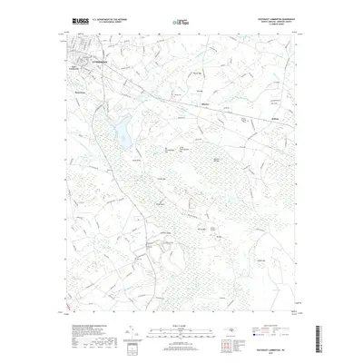
2019 Map of Southeast Lumberton
USGS Topo · Published 2019About this map
Lumberton and its southeastern rural reaches are defined by a complex mosaic of Carolina bays and low-lying swamplands that have historically shaped the development of Robeson County. The Lumber River and Jacob Swamp form the primary drainage, creating a landscape where agricultural land is often interrupted by distinct geological depressions such as Warwick Mill Bay, Bear Bay, and Pine Bay. The industrial presence is marked by the Plant Cooling Lake and Ash Pond situated near Horse Bluff, reflecting the infrastructure required to support the local population. For genealogists, this 2019 survey documents several essential sites including Hollywood Cem, Wishart Cem, and Britt Cem. Smaller settlements like Allenton and Bellamy sit at crossroads east of the city, while neighborhoods such as Hestertown and East Lumberton anchor the urban edge. The map also records substantial wetlands like Lennon Pond and Big Bay, illustrating the persistent hydraulic character of the coastal plain south of the city center.
Find a feature on this map
146 named features on this map. Tap any name to fly to it.
Don’t see what you’re looking for? This feature index may not catch every label — zoom into the map to look around manually.
Map Details
Editions of this 2019 Southeast Lumberton Map
This is the sole edition of this map. No revisions or reprints were ever made.
Other maps of this area

1943 · Pages Mill
USGS Topo · 1:62,500

1953 · Chadbourn
USGS Topo · 1:62,500

1953 · Florence
USGS Topo · 1:250,000

1954 · Florence
USGS Topo · 1:250,000

1957 · Bladenboro
USGS Topo · 1:62,500

1962 · Fairmont
USGS Topo · 1:24,000

1962 · Fair Bluff
USGS Topo · 1:62,500

1972 · Northwest Lumberton
USGS Topo · 1:24,000

1972 · Southwest Lumberton
USGS Topo · 1:24,000
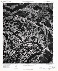
1976 · Southwest Lumberton
USGS Topo · 1:24,000