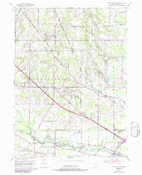
1952 Map of Southington
USGS Topo · Published 1986About this map
The Mahoning River and Eagle Creek define the southern landscape of this Trumbull County region, where the town of Southington serves as a central hub for the surrounding rural townships. During the early 1950s, the area maintained a distinct agricultural character, intersected by the critical transport corridor of the Baltimore and Ohio railroad. Smaller hamlets like Stroups and Delightful are scattered across the terrain, connected by thoroughfares such as State Road and Old State Road. Local history is preserved at the Reform Cem and other small burial grounds, while the presence of the Warren Airfield and a Golf Course indicates the post-war expansion of local infrastructure and recreation. The mapping also captures technical details of the era's energy and water management, including a prominent pipeline and a gaging station near the rail line.
Find a feature on this map
31 named features on this map. Tap any name to fly to it.
Don’t see what you’re looking for? This feature index may not catch every label — zoom into the map to look around manually.
Map Details
Editions of this 1952 Southington Map
3 editions found
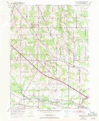
Other maps of this area

1905 · Bristolville
USGS Topo · 1:62,500

1905 · Garrettsville
USGS Topo · 1:62,500

1906 · Ravenna
USGS Topo · 1:62,500

1907 · Bristolville
USGS Topo · 1:62,500

1907 · Garrettsville
USGS Topo · 1:62,500

1908 · Warren
USGS Topo · 1:62,500

1908 · Ravenna
USGS Topo · 1:62,500

1950 · Cleveland
USGS Topo · 1:250,000

1952 · West Farmington
USGS Topo · 1:24,000

1952 · Southington
USGS Topo · 1:24,000
Featured Places
- Warren, OH
- Champion Township, OH
- Warren Township, OH
- Southington Township, OH
- Southington, Southington Township