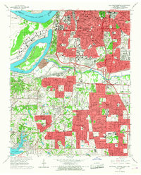
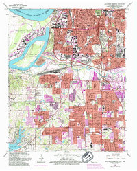
1965 Map of Southwest Memphis
USGS Topo · Published 1967About this map
Industrial and residential expansion in South Memphis is documented here just before the era of major suburban consolidation. The map reveals the critical intersection of logistics and landscape, where the Mississippi River and Harbor Channel define the western edge of Presidents Island No 45. Significant land use is dedicated to the massive Defense Depot Memphis and the expanding infrastructure of the Illinois Central railroad. To the south, the community of Whitehaven shows a dense network of local schools and churches, including Whitehaven High Sch and Holy Cross Ch. Cultural and historical continuity is anchored by prominent burial grounds like Elmwood Cemetery and Forest Hill Cemetery, alongside institutions like LeMoyne College. The map also captures the recreational and natural spaces of T O Fuller State Park and the winding course of Nonconnah Creek.
Find a feature on this map
87 named features on this map. Tap any name to fly to it.
Don’t see what you’re looking for? This feature index may not catch every label — zoom into the map to look around manually.
Map Details
Editions of this 1965 Southwest Memphis Map
5 editions found
Other maps of this area

1908 · Lake Cormorant
USGS Topo · 1:24,000

1912 · Lake Cormorant
USGS Topo · 1:31,680

1916 · Memphis
USGS Topo · 1:62,500

1925 · Memphis
USGS Topo · 1:48,000

1927 · Memphis
USGS Topo · 1:62,500

1932 · Horn Lake
USGS Topo · 1:48,000

1935 · Horn Lake
USGS Topo · 1:62,500

1939 · Memphis
USGS Topo · 1:62,500

1944 · Hernando
USGS Topo · 1:62,500

1948 · Helena
USGS Topo · 1:250,000