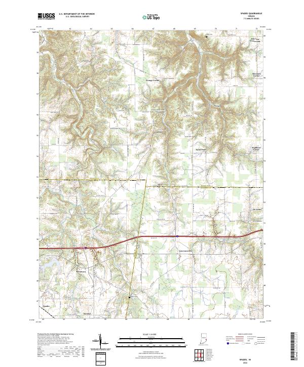
2022 Map of Spades
USGS Topo · Published 2022About this map
The tri-county boundary where Franklin, Ripley, and Dearborn counties meet defines the social and civic landscape of this corner of southeastern Indiana. Numerous unincorporated settlements and rural junctions like Youngs Corner, Klemmes Corner, and Oak Tree Crossroads are connected by a dense network of country roads including Saint Mary Rd and Lammers Pike. The terrain is deeply etched by the drainage of Blue Creek and Pipe Creek, which creates a complex series of ridges and hollows that historically dictated the placement of early farmsteads and cemeteries.
Find a feature on this map
100 named features on this map. Tap any name to fly to it.
Don’t see what you’re looking for? This feature index may not catch every label — zoom into the map to look around manually.
Map Details
Editions of this 2022 Spades Map
This is the sole edition of this map. No revisions or reprints were ever made.
Other maps of this area

1915 · Lawrenceburg
USGS Topo · 1:48,000

1915 · Harrison
USGS Topo · 1:48,000

1928 · Lawrenceburg
USGS Topo · 1:62,500

1932 · Lawrenceburg
USGS Topo · 1:62,500

1943 · Guilford
USGS Topo · 1:24,000

1946 · Pierceville
USGS Topo · 1:24,000

1946 · Batesville
USGS Topo · 1:24,000

1953 · Guilford
USGS Topo · 1:24,000

1953 · Cincinnati
USGS Topo · 1:250,000

1955 · Mount Carmel
USGS Topo · 1:24,000