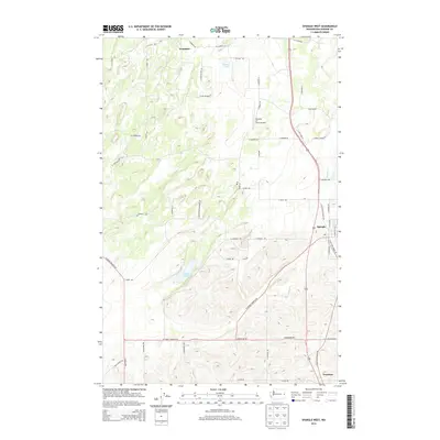
2014 Map of Spangle West
USGS Topo · Published 2014About this map
Spangle anchors the eastern edge of this Washington landscape, situated along the corridor of S Old State Highway 195. To the south, the small community of Freedom sits near the Spokane County line, while Dynamite occupies the northern reaches of the map. The terrain is characterized by a network of drainage ways and seasonal water bodies, including Philleo Lake, Hansens Pond, and the winding paths of Marshall Cr and Spangle Cr.
Find a feature on this map
57 named features on this map. Tap any name to fly to it.
Don’t see what you’re looking for? This feature index may not catch every label — zoom into the map to look around manually.
Map Details
Editions of this 2014 Spangle West Map
This is the sole edition of this map. No revisions or reprints were ever made.
Other maps of this area

1901 · Spokane
USGS Topo · 1:125,000

1903 · Oakesdale
USGS Topo · 1:125,000

1905 · Oakesdale
USGS Topo · 1:125,000

1943 · Medical Lake
USGS Topo · 1:62,500

1950 · Spokane SE
USGS Topo · 1:24,000

1950 · Spokane SW
USGS Topo · 1:24,000

1950 · Spokane
USGS Topo · 1:62,500

1954 · Medical Lake
USGS Topo · 1:62,500

1954 · Cheney
USGS Topo · 1:62,500

1954 · Spangle
USGS Topo · 1:62,500