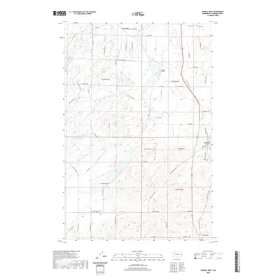
2020 Map of Spangle West
USGS Topo · Published 2020About this map
Spangle anchors the eastern edge of this landscape, where the basalt-rimmed scablands of eastern Washington meet the rolling agricultural plateaus of Spokane County. The terrain is defined by dramatic depressions and drainage patterns, including Philleo Lake and Hansens Pond, which sit among the coulees west of the town center. The rural character of the area is emphasized by dispersed settlements like Dynamite to the north and Freedom at the southern boundary. Local transit and aviation are represented by the corridor of Highway 195 and the presence of Paradise Air Ranch. Genealogists and local historians will find the Spangle Cem situated south of the main township, while the winding course of Spangle Cr illustrates the natural hydrology that likely influenced early land use and property boundaries throughout the region.
Find a feature on this map
58 named features on this map. Tap any name to fly to it.
Don’t see what you’re looking for? This feature index may not catch every label — zoom into the map to look around manually.
Map Details
Editions of this 2020 Spangle West Map
This is the sole edition of this map. No revisions or reprints were ever made.
Other maps of this area

1901 · Spokane
USGS Topo · 1:125,000

1903 · Oakesdale
USGS Topo · 1:125,000

1905 · Oakesdale
USGS Topo · 1:125,000

1943 · Medical Lake
USGS Topo · 1:62,500

1950 · Spokane SE
USGS Topo · 1:24,000

1950 · Spokane SW
USGS Topo · 1:24,000

1950 · Spokane
USGS Topo · 1:62,500

1954 · Medical Lake
USGS Topo · 1:62,500

1954 · Cheney
USGS Topo · 1:62,500

1954 · Spangle
USGS Topo · 1:62,500