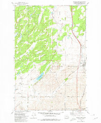
1980 Map of Spangle West
USGS Topo · Published 1980About this map
Spangle serves as the primary hub in this corner of Spokane County, where the Burlington Northern railroad lines run parallel to the local creek systems. The landscape transitions from the agricultural flats near Pine Grove Road and the Pine Grove PO to the complex wetlands and basalt-influenced terrain of the Turnbull Nat Wildlife Refuge. Water dominates the western portion of the sheet, defined by Philleo Lake and Stubblefield Lake, which sit amidst a network of scabland depressions and seasonal pools.
Find a feature on this map
34 named features on this map. Tap any name to fly to it.
Don’t see what you’re looking for? This feature index may not catch every label — zoom into the map to look around manually.
Map Details
Editions of this 1980 Spangle West Map
This is the sole edition of this map. No revisions or reprints were ever made.
Other maps of this area

1901 · Spokane
USGS Topo · 1:125,000

1903 · Oakesdale
USGS Topo · 1:125,000

1905 · Oakesdale
USGS Topo · 1:125,000

1943 · Medical Lake
USGS Topo · 1:62,500

1950 · Spokane SE
USGS Topo · 1:24,000

1950 · Spokane SW
USGS Topo · 1:24,000

1950 · Spokane
USGS Topo · 1:62,500

1954 · Medical Lake
USGS Topo · 1:62,500

1954 · Cheney
USGS Topo · 1:62,500

1954 · Spangle
USGS Topo · 1:62,500