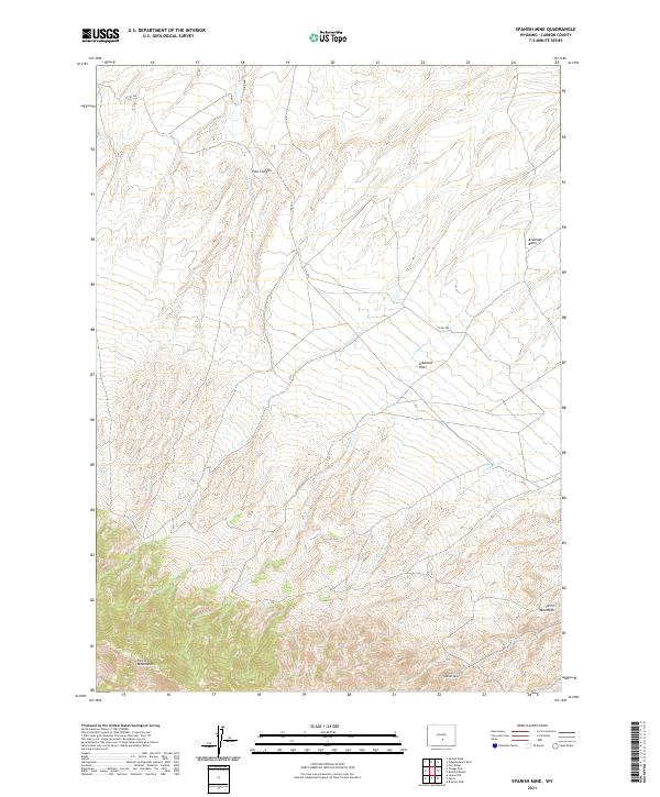
2021 Map of Spanish Mine
USGS Topo · Published 2021About this map
The Ferris Mountains dominate the southern landscape of this Carbon County quadrangle, where high-elevation terrain transitions into the broad drainage basins of central Wyoming. This modern survey illustrates a rugged ranching and mining environment defined by deep natural draws like Pole Canyon and expansive grazing lands such as Arkansas Flats. The namesake Spanish Mine is situated among these peaks, representing the long-standing mineral interests that have shaped the human footprint in this part of the state. Water remains the primary shaper of the valley floors, with Arkansas Cr and its tributaries, including E Arkansas Cr, carving through the Arkansas Basin. The presence of established routes like Co RD 499 provides insight into the infrastructure required to service these remote upland sites.
Find a feature on this map
17 named features on this map. Tap any name to fly to it.
Don’t see what you’re looking for? This feature index may not catch every label — zoom into the map to look around manually.
Map Details
Editions of this 2021 Spanish Mine Map
This is the sole edition of this map. No revisions or reprints were ever made.
Other maps of this area

1951 · Savage Peak
USGS Topo · 1:24,000

1951 · Independence Rock
USGS Topo · 1:24,000

1951 · Fort Ridge
USGS Topo · 1:24,000

1953 · Bradley Peak
USGS Topo · 1:24,000

1953 · Ferris
USGS Topo · 1:24,000

1953 · Buzzard Ranch
USGS Topo · 1:24,000

1953 · Spanish Mine
USGS Topo · 1:24,000

1955 · Casper
USGS Topo · 1:250,000

1958 · Casper
USGS Topo · 1:250,000

1961 · Lamont NE
USGS Topo · 1:24,000