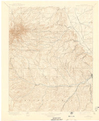
1897 Map of Spanish Peaks
USGS Topo · Published 1942About this map
The West Spanish Peak and East Spanish Peak dominate the high country of the San Isabel National Forest, serving as the primary landmarks for this late 19th-century survey of the Huerfano and Las Animas county line. The map reveals a transition from the mountainous western terrain into the canyon-riven foothills and the coal-mining corridors to the east. The Purgatoire River winds across the southern reaches, passing through small settlements like Weston and Tijeras (Madrid P.O.).
Find a feature on this map
82 named features on this map. Tap any name to fly to it.
Don’t see what you’re looking for? This feature index may not catch every label — zoom into the map to look around manually.
Map Details
Editions of this 1897 Spanish Peaks Map
5 editions found

Other maps of this area

1889 · Huerfano Park
USGS Topo · 1:125,000

1891 · Walsenburg
USGS Topo · 1:125,000

1891 · Spanish Peaks
USGS Topo · 1:125,000

1891 · Apishapa
USGS Topo · 1:125,000

1892 · Huerfano Park
USGS Topo · 1:125,000

1892 · Elmoro
USGS Topo · 1:125,000

1893 · Spanish Peaks
USGS Topo · 1:125,000

1893 · Apishapa
USGS Topo · 1:125,000

1893 · Elmoro
USGS Topo · 1:125,000

1894 · Walsenburg
USGS Topo · 1:125,000