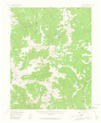
1957 Map of Spar City
USGS Topo · Published 1963About this map
The settlement of Spar City sits at the edge of the Rio Grande National Forest in this mid-century survey, a landscape defined by high peaks and the headwaters of the Rio Grande. Mining history is visible in the northwest through the Denver Tunnel near Monument Peak, while the surrounding terrain is laced with numerous named water bodies including Lake Humphreys, Goose Lake, and Shaw Lake. The map details a primitive transportation network consisting of several designated Pack Trails crossing the Continental Divide and the New Mexico Principal Meridian. This 1957 field-checked survey captures the area before modern development, showing isolated features like the Wagon Wheel Ranch and Decker Meadows tucked between summits like South River Peak and Beautiful Mtn. The division between the Rio Grande and San Juan National Forest creates a administrative boundary through the high-altitude wilderness of the San Juan Mountains.
Find a feature on this map
66 named features on this map. Tap any name to fly to it.
Don’t see what you’re looking for? This feature index may not catch every label — zoom into the map to look around manually.
Map Details
Editions of this 1957 Spar City Map
5 editions found

Other maps of this area

1905 · San Cristobal
USGS Topo · 1:125,000

1907 · San Cristobal
USGS Topo · 1:125,000

1913 · Summitville
USGS Topo · 1:125,000

1914 · Creede
USGS Topo · 1:125,000

1915 · Summitville
USGS Topo · 1:125,000

1916 · Creede
USGS Topo · 1:125,000

1924 · Pagosa Springs
USGS Topo · 1:125,000

1927 · Pagosa Springs
USGS Topo · 1:125,000

1945 · Durango
USGS Topo · 1:250,000

1953 · Durango
USGS Topo · 1:250,000