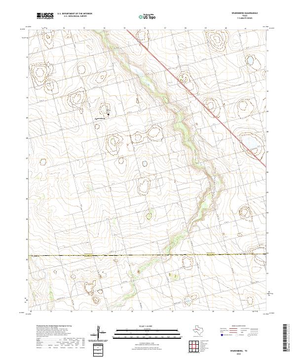
2022 Map of Sparenberg
USGS Topo · Published 2022About this map
Sparenberg sits near the northern edge of this West Texas landscape, serving as a focal point for the surrounding agricultural grid that spans the border of Dawson Co and Martin Co. The settlement's community history is anchored by the Grace Lutheran Cem, located just north of the town center along FM 26 N. The terrain is defined by the subtle, winding path of Sulphur Springs Draw, which cuts diagonally across the eastern half of the map, contrasting with the rigid geometry of the local section roads.
Find a feature on this map
27 named features on this map. Tap any name to fly to it.
Don’t see what you’re looking for? This feature index may not catch every label — zoom into the map to look around manually.
Map Details
Editions of this 2022 Sparenberg Map
This is the sole edition of this map. No revisions or reprints were ever made.
Other maps of this area

1954 · Big Spring
USGS Topo · 1:250,000

1958 · Big Spring
USGS Topo · 1:250,000

1966 · Knott
USGS Topo · 1:24,000

1966 · Merrick
USGS Topo · 1:24,000

1966 · Flower Grove
USGS Topo · 1:24,000

1970 · Lamesa South
USGS Topo · 1:24,000

1970 · Ackerly
USGS Topo · 1:24,000

1970 · Key
USGS Topo · 1:24,000
1970 · Tenmile
USGS Topo · 1:24,000

1970 · Sand Creek
USGS Topo · 1:24,000