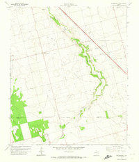
1970 Map of Sparenberg
USGS Topo · Published 1974About this map
Sparenberg sits at the heart of this West Texas landscape, where the flat plains of the Llano Estacado meet the industrial footprint of the Ackerly Oil Field. The 1970 survey reveals a land organized by petroleum extraction and ranching, dominated by a dense network of oil wells, storage facilities, and an extensive pipeline system. The most prominent natural feature is Sulphur Springs Draw, which snakes diagonally across the terrain, dotted with numerous gravel pits that suggest active local excavation during this era.
Find a feature on this map
21 named features on this map. Tap any name to fly to it.
Don’t see what you’re looking for? This feature index may not catch every label — zoom into the map to look around manually.
Map Details
Editions of this 1970 Sparenberg Map
This is the sole edition of this map. No revisions or reprints were ever made.
Other maps of this area

1954 · Big Spring
USGS Topo · 1:250,000

1958 · Big Spring
USGS Topo · 1:250,000

1966 · Knott
USGS Topo · 1:24,000

1966 · Merrick
USGS Topo · 1:24,000

1966 · Flower Grove
USGS Topo · 1:24,000

1970 · Lamesa South
USGS Topo · 1:24,000

1970 · Ackerly
USGS Topo · 1:24,000

1970 · Key
USGS Topo · 1:24,000
1970 · Tenmile
USGS Topo · 1:24,000

1970 · Sand Creek
USGS Topo · 1:24,000