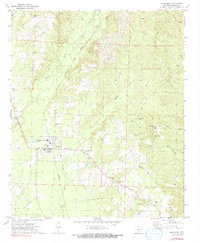
1971 Map of Sparkman
USGS Topo · Published 1991About this map
Sparkman serves as the primary hub of this Dallas County landscape, anchored by a grid of streets and the Chicago Rock Island and Pacific railroad line. While the tracks remain active through the center of town, a branch to the south is marked as Abandoned, illustrating the shifting logistics of the local timber or agricultural economy. The surrounding countryside is dotted with small rural communities and spiritual centers such as New Hope, Pine Grove, and Macedonia Ch.
Find a feature on this map
27 named features on this map. Tap any name to fly to it.
Don’t see what you’re looking for? This feature index may not catch every label — zoom into the map to look around manually.
Map Details
Editions of this 1971 Sparkman Map
2 editions found
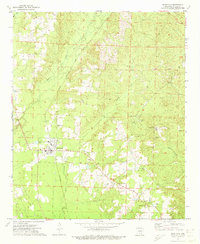
Other maps of this area

1903 · Camden
USGS Topo · 1:125,000

1953 · El Dorado
USGS Topo · 1:250,000

1955 · Little Rock
USGS Topo · 1:250,000

1956 · Little Rock
USGS Topo · 1:250,000

1957 · El Dorado
USGS Topo · 1:250,000

1958 · El Dorado
USGS Topo · 1:250,000

1960 · El Dorado
USGS Topo · 1:250,000

1960 · Little Rock
USGS Topo · 1:250,000

1964 · Little Rock
USGS Topo · 1:250,000
1965 · Dalark
USGS Topo · 1:24,000