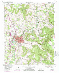
1954 Map of Sparta
USGS Topo · Published 1980About this map
Sparta serves as the focal point of this mid-century landscape, positioned where the Louisville and Nashville railroad tracks cross the meandering Calfkiller River. The map illustrates a developed local core featuring a courthouse, multiple schools such as West Sch and East Sch, and industrial elements like the City Water Plant and a nearby Substation. To the north, the small settlement of Findlay is marked by the Radio Tower (WSMT) and a Drive-in Theater, reflecting post-war cultural growth.
Find a feature on this map
57 named features on this map. Tap any name to fly to it.
Don’t see what you’re looking for? This feature index may not catch every label — zoom into the map to look around manually.
Map Details
Editions of this 1954 Sparta Map
3 editions found

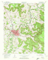
Other maps of this area

1892 · Pikeville
USGS Topo · 1:125,000

1893 · Mc Minnville
USGS Topo · 1:125,000

1895 · Mc Minnville
USGS Topo · 1:125,000

1895 · Pikeville
USGS Topo · 1:125,000

1897 · Standingstone
USGS Topo · 1:125,000

1898 · Standingstone
USGS Topo · 1:125,000

1943 · Cookeville
USGS Topo · 1:100,000

1944 · Cookeville
USGS Topo · 1:100,000

1953 · Chattanooga
USGS Topo · 1:250,000

1954 · De Rossett
USGS Topo · 1:24,000