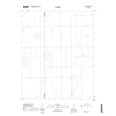
2019 Map of Spearman NE
USGS Topo · Published 2019About this map
The high plains along the border of Hansford Co and Ochiltree Co are characterized by a precise grid of rural routes and occasional playa lakes. In this 2019 survey, the landscape is defined by its agricultural layout, where FM 759 serves as a primary east-west artery through the central portion of the quadrangle. Significant local history is preserved at Black Cem, a small burial ground located in the eastern half of the map near the intersection of Co RD W and Co RD 4. The terrain is generally level, with subtle drainage patterns influencing the placement of north-south connectors like Co RD 30 and Co RD 2. This map provides a clear record of modern property divisions and transportation networks, such as Co RD Aa at the southern boundary, reflecting the enduring rural character of the Texas Panhandle.
Find a feature on this map
16 named features on this map. Tap any name to fly to it.
Don’t see what you’re looking for? This feature index may not catch every label — zoom into the map to look around manually.
Map Details
Editions of this 2019 Spearman NE Map
This is the sole edition of this map. No revisions or reprints were ever made.
Other maps of this area

1954 · Perryton
USGS Topo · 1:250,000

1958 · Perryton
USGS Topo · 1:250,000

1962 · Waka SW
USGS Topo · 1:24,000

1962 · Spearman
USGS Topo · 1:24,000

1973 · Farnsworth
USGS Topo · 1:24,000

1973 · Waka
USGS Topo · 1:24,000

1973 · Sourdough Creek SW
USGS Topo · 1:24,000

1973 · Spearman NE
USGS Topo · 1:24,000

1973 · Sourdough Creek NW
USGS Topo · 1:24,000

1973 · Spearman SE
USGS Topo · 1:24,000