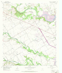
1957 Map of Speegleville
USGS Topo · Published 1971About this map
The North Bosque River, Middle Bosque River, and South Bosque River converge in this central Texas landscape, where the rising waters of the Waco Reservoir meet the surrounding prairie. This mid-century survey documents a rural community in transition, centering on the small settlement of Speegleville and the outlying clusters at Ocee and Willow Grove. The presence of established river crossings like Caldwell Crossing and Eichelberger Crossing alongside more modern developments, such as the Val Verde (Camp Fire Girls Camp) and a private Landing Strip, illustrates the evolving land use as the reservoir infrastructure altered the local geography. Numerous Gravel Pit sites and an Oil Well dot the terrain, while landmarks like Shiloh Ch, Evergreen Cem, and Mc Lennan Cem provide essential anchor points for genealogists tracing family roots in this corner of McLennan County.
Find a feature on this map
29 named features on this map. Tap any name to fly to it.
Don’t see what you’re looking for? This feature index may not catch every label — zoom into the map to look around manually.
Map Details
Editions of this 1957 Speegleville Map
4 editions found
Other maps of this area

1892 · Temple
USGS Topo · 1:125,000

1892 · Waco
USGS Topo · 1:125,000

1920 · Waco
USGS Topo · 1:125,000

1924 · Waco 4-c
USGS Topo · 1:48,000

1924 · Waco 3-d
USGS Topo · 1:48,000

1931 · Valley Mills
USGS Topo · 1:62,500

1931 · Elm Mott
USGS Topo · 1:62,500

1931 · Mc Gregor
USGS Topo · 1:62,500

1954 · Waco
USGS Topo · 1:250,000

1955 · Waco
USGS Topo · 1:250,000