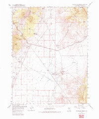
1960 Map of Spencer Hot Springs
USGS Topo · Published 1985About this map
The Smoky Valley serves as a central corridor for historical western transit in this mid-century survey of Lander County. This map documents a high-desert landscape defined by legacy transportation arteries, including the Pony Express Route, the Overland Stage Route, and the Simpson Park Canyon Route. A notable historical point is the Cape Horn Overland Stage Station (Site), marking the intersection of early pioneer communication and travel through the Simpson Park Mts.
Find a feature on this map
33 named features on this map. Tap any name to fly to it.
Don’t see what you’re looking for? This feature index may not catch every label — zoom into the map to look around manually.
Map Details
Editions of this 1960 Spencer Hot Springs Map
3 editions found
Other maps of this area

1926 · Roberts Mountains
USGS Topo · 1:250,000

1929 · Roberts Mountains
USGS Topo · 1:250,000

1955 · Millett
USGS Topo · 1:250,000

1956 · Mount Callaghan
USGS Topo · 1:62,500

1956 · Millett Ranch
USGS Topo · 1:62,500

1956 · Ackerman Canyon
USGS Topo · 1:62,500

1956 · Austin
USGS Topo · 1:62,500

1959 · Millett
USGS Topo · 1:250,000

1960 · Hickison Summit
USGS Topo · 1:62,500

1960 · Spencer Hot Springs
USGS Topo · 1:62,500