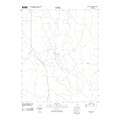
2010 Map of Spencer Lake
USGS Topo · Published 2010About this map
Spencer Lake and its accompanying Spencer Lake Dam serve as a central geographic anchor for this section of the Texas Panhandle. The landscape is defined by an intricate network of drainage systems, most notably Little Gyp Creek and Gyp Creek, which weave through the terrain toward the southern boundary. This 2010 survey records a rural environment where infrastructure is sparse, characterized primarily by ranch roads like Ranch Rd 2895 and isolated landmarks such as the Hess Windmill. In the southeast corner, the Salt Fork Red River makes a brief appearance, marking a significant hydrologic transition. The presence of several named western tributaries, including Whitefish Creek and Skillet Creek, reflects a region shaped by the intermittent water sources essential for cattle ranching and local land management.
Find a feature on this map
12 named features on this map. Tap any name to fly to it.
Don’t see what you’re looking for? This feature index may not catch every label — zoom into the map to look around manually.
Map Details
Editions of this 2010 Spencer Lake Map
This is the sole edition of this map. No revisions or reprints were ever made.
Other maps of this area

1954 · Amarillo
USGS Topo · 1:250,000

1954 · Plainview
USGS Topo · 1:250,000

1958 · Amarillo
USGS Topo · 1:250,000

1958 · Plainview
USGS Topo · 1:250,000

1959 · Lelia Lake Creek
USGS Topo · 1:24,000

1959 · Troublesome Creek
USGS Topo · 1:24,000

1959 · Spencer Lake
USGS Topo · 1:24,000

1959 · McKnight
USGS Topo · 1:24,000

1963 · Alanreed
USGS Topo · 1:24,000

1963 · Ramsdell
USGS Topo · 1:24,000