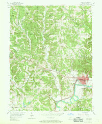
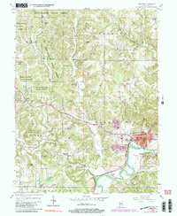
1956 Map of Spencer
USGS Topo · Published 1958About this map
The White River defines the southeastern corner of this Owen County landscape, where the town of Spencer sits at a strategic bend. During the mid-1950s, the area's rural character is evident in the dense network of family cemeteries and country churches, such as Wesley Chapel and the New Union Ch, which served the surrounding farming and timbering communities. The vast acreage of the Owen State Forest dominates the northern and western sections of the map, punctuated by numerous named heights including Cooksey Hill and Gaston Hill.
Find a feature on this map
46 named features on this map. Tap any name to fly to it.
Don’t see what you’re looking for? This feature index may not catch every label — zoom into the map to look around manually.
Map Details
Editions of this 1956 Spencer Map
5 editions found
Other maps of this area

1908 · Bloomington
USGS Topo · 1:48,000

1908 · Bloomfield
USGS Topo · 1:62,500

1910 · Bloomington
USGS Topo · 1:62,500

1947 · Gosport
USGS Topo · 1:24,000

1949 · Quincy
USGS Topo · 1:24,000

1950 · Gosport
USGS Topo · 1:24,000

1950 · Arney
USGS Topo · 1:24,000

1953 · Indianapolis
USGS Topo · 1:250,000

1956 · Indianapolis
USGS Topo · 1:250,000

1956 · Cataract
USGS Topo · 1:24,000