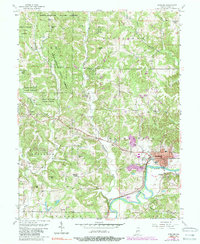
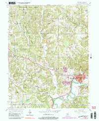
1956 Map of Spencer
USGS Topo · Published 1989About this map
Spencer serves as the focal point for this mid-century survey of Owen County, situated where the White River makes a dramatic bend. The landscape is characterized by a dense network of family-named cemeteries and rural churches that speak to the deep ancestral roots of the region. Notable landmarks like Wesley Chapel and New Union Ch appear alongside numerous burial grounds such as St Walley Cem and Palestine Cem, marking the spiritual and social hubs of the rural townships.
Find a feature on this map
50 named features on this map. Tap any name to fly to it.
Don’t see what you’re looking for? This feature index may not catch every label — zoom into the map to look around manually.
Map Details
Editions of this 1956 Spencer Map
5 editions found
Other maps of this area

1908 · Bloomington
USGS Topo · 1:48,000

1908 · Bloomfield
USGS Topo · 1:62,500

1910 · Bloomington
USGS Topo · 1:62,500

1947 · Gosport
USGS Topo · 1:24,000

1949 · Quincy
USGS Topo · 1:24,000

1950 · Gosport
USGS Topo · 1:24,000

1950 · Arney
USGS Topo · 1:24,000

1953 · Indianapolis
USGS Topo · 1:250,000

1956 · Indianapolis
USGS Topo · 1:250,000

1956 · Cataract
USGS Topo · 1:24,000