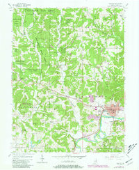
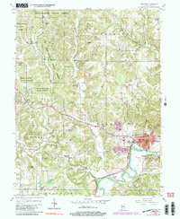
1956 Map of Spencer
USGS Topo · Published 1981About this map
White River oxbows through the southeastern corner of this quadrangle, defining the southern boundary of Spencer, the county seat. The town is shown in detail, including the Riverside Cem and its connection to the Conrail rail line. To the west, the landscape is heavily wooded and hilly, dominated by the Owen-Putnam State Forest. This rugged terrain is dotted with small family and church burial grounds, including Pleasant Grove Cem, Kaufman Cem, and Gibson Cem, which provide significant value for genealogical research in Washington and Montgomery townships.
Find a feature on this map
48 named features on this map. Tap any name to fly to it.
Don’t see what you’re looking for? This feature index may not catch every label — zoom into the map to look around manually.
Map Details
Editions of this 1956 Spencer Map
5 editions found
Other maps of this area

1908 · Bloomington
USGS Topo · 1:48,000

1908 · Bloomfield
USGS Topo · 1:62,500

1910 · Bloomington
USGS Topo · 1:62,500

1947 · Gosport
USGS Topo · 1:24,000

1949 · Quincy
USGS Topo · 1:24,000

1950 · Gosport
USGS Topo · 1:24,000

1950 · Arney
USGS Topo · 1:24,000

1953 · Indianapolis
USGS Topo · 1:250,000

1956 · Indianapolis
USGS Topo · 1:250,000

1956 · Cataract
USGS Topo · 1:24,000