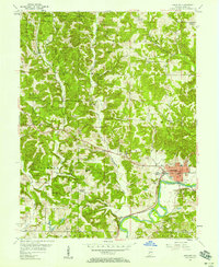
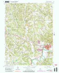
1956 Map of Spencer
USGS Topo · Published 1965About this map
The White River anchors the southeastern corner of this Owen County landscape, winding past the community of Spencer where the Pennsylvania railroad line tracks along the valley floor. The terrain rises sharply to the west into the wooded heights of the Owen State Forest, a dissected plateau marked by numerous family-named peaks such as Cooksey Hill, Gaston Hill, and Wolfe Hill. This mid-century survey reveals a rural infrastructure of small settlements like Vandalia and Hancock Corner, connected by a network of winding roads that follow the ridges between Rattlesnake Creek and the West Fork. Numerous small family burial grounds and country churches, including Witham Cem and New Union Ch, are scattered throughout the hills, providing a detailed record of the area's genealogical footprint before later 20th-century development altered the local landscape.
Find a feature on this map
43 named features on this map. Tap any name to fly to it.
Don’t see what you’re looking for? This feature index may not catch every label — zoom into the map to look around manually.
Map Details
Editions of this 1956 Spencer Map
5 editions found
Other maps of this area

1908 · Bloomington
USGS Topo · 1:48,000

1908 · Bloomfield
USGS Topo · 1:62,500

1910 · Bloomington
USGS Topo · 1:62,500

1947 · Gosport
USGS Topo · 1:24,000

1949 · Quincy
USGS Topo · 1:24,000

1950 · Gosport
USGS Topo · 1:24,000

1950 · Arney
USGS Topo · 1:24,000

1953 · Indianapolis
USGS Topo · 1:250,000

1956 · Indianapolis
USGS Topo · 1:250,000

1956 · Cataract
USGS Topo · 1:24,000